Are We Doing Enough to Protect NC 12 from Climate Change?


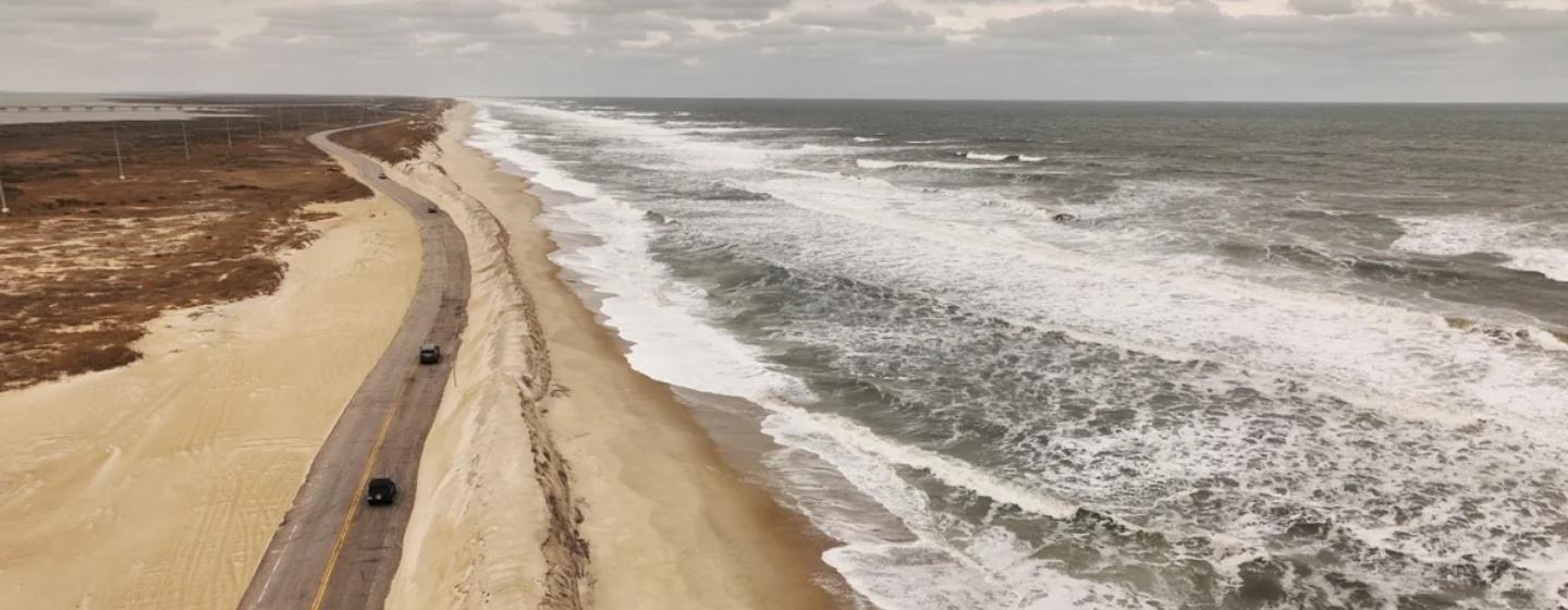
NC Highway 12 not only offers a beautiful drive along the coast, it’s also a vital lifeline for residents and visitors to Ocracoke Island along the Outer Banks.
Yes, ferries from Cedar Island and Swan Quarter arriving at and departing from the island’s South Dock Ferry Terminal provide access; however, those have limited daily service. It’s the ribbon of roadway that spans the 16-mile length of the island, from Oregon Inlet to Hatteras Village and the ferry docks, that provides visitors and residents continuous access.
That’s only if the highway is passable.
More and more often, storms and high tides cover the roadway with floodwaters from the Atlantic Ocean to the east and Pamlico Sound to the west. The overwash carries in mountains of sand that cover the roadway, which is then closed until it can be cleared. Climate change is accelerating the frequency and intensity of storms.
Which is why the National Park Service (NPS), which manages the Cape Hatteras National Seashore that NC 12 runs through, is asking UNC-Chapel Hill’s Collaboratory for Coastal Adaptation over Space & Time, or C-CoAST, to study how erosion impacts transportation on the island.
Ocracoke Island is one of many barrier islands that make up North Carolina’s Outer Banks. It’s a well-known and popular vacation destination, but it’s also a constantly shifting island carved by waves and wind.
For decades, state transportation officials have utilized giant sandbags and built massive dunes to keep waters from the ocean and sound at bay. Giant bulldozers and other heavy equipment are on constant standby to clear sand from storm events off the roadway.
But with the problem getting worse, NPS said in a news release it wants to better understand whether the practices used to keep the road open “may have inadvertently contributed to the low elevations and narrow island widths that currently make transportation susceptible to disruption from multiple sources including ocean overwash, sound side flooding and heavy precipitation events.”
That’s right—the current coastal management strategy might be making things worse.
Computer modeling shows some coastal management activities meant to protect barrier islands from sea level rise can disrupt the natural processes that keep islands above water.
“Counterintuitively, the more successful humans are in preventing storm impacts, the less resilient the barrier system becomes in the long term,” said C-CoAST Director and the study’s co-author Laura Moore in a Duke news release.
The National Park Service hopes the study will help determine how to walk the fine line between adapting transportation systems to climate impacts while also preserving the island’s natural processes. That includes modeling the effects of keeping NC 12 where it is versus how the barrier island would migrate in response to other alternatives, including relocating parts of the highway or creating alternative ways to protect it.
The study shows that moving away from current practices—like bulldozing sand to create massive dunes to protect the road—may allow natural barriers that would have become uninhabitable to rebound and keep up with sea level rise longer.
While the study showed there is no easy solution and there will be tradeoffs, doing nothing is not an option.
“There’s no perfect solution,” said Katherine Anarde, the study’s lead author and assistant professor of coastal engineering at NC State. “Understanding an entire barrier system and how it responds to different coastal management decisions is critical to assessing the sustainability of coastal development over the coming decades. The model helps us consider several factors in managing coastal areas to ensure we’re not unintentionally making things worse in the long run, and to weigh the tradeoffs.”