New Technology for a Possibly ‘Extraordinary Season’
It’s a dangerous cocktail of conditions.
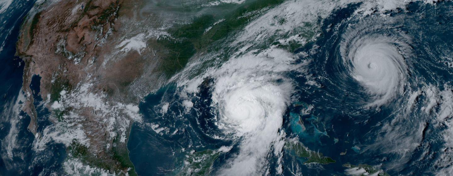
With La Niña conditions developing in the Pacific and near record warm waters in the Atlantic, meteorologists at the National Hurricane Center issued a forecast for named storms, hurricanes and major hurricanes that is the highest ever for its seasonal outlook.
The agency expects 17 to 25 storms to form in the Atlantic this season. At least eight of those are forecast to be hurricanes, with four to seven expected to be major hurricanes. Forecasters say there’s an 85% chance of more storms than usual.
The hurricane season spans from June 1 through November 30, with most activity occurring between mid-August and mid-October. An average season has 14 named storms, seven hurricanes and three major hurricanes.
For the first time, forecasters will use AI (artificial intelligence), combined with an array of additional new technologies, to keep an eye on developing tropical cyclones and their projected paths.
“This season is looking to be an extraordinary one,” said Rick Spinrad, administrator of the National Ocean and Atmospheric Administration (NOAA), which houses the National Hurricane Center, during a media briefing about the new forecast.
The agency also released the names for tropical storms for the new season.
All the ingredients for big storms
One reason for the substantial number of expected storms is that El Niño and La Niña climate patterns are changing, which means wind conditions in the Atlantic and Caribbean are expected to be favorable for hurricane formation.
The changes naturally occur, but this year the switch coincides with the conditions for an active hurricane season already in place.
Forecasters admit it’s always difficult to predict wind conditions. But as one of the strongest El Niños ever seen is ending, NOAA predicts a quick transition to La Niña conditions, which are more conducive to Atlantic hurricane activity. That’s because the vertical wind patterns, or wind shear, that weaken hurricanes are less common. La Niña is expected to take hold by late summer, the peak of hurricane season.
However, the biggest risk factor for major hurricanes developing is the abnormally warm water temperatures throughout the Atlantic. Warm water fuels storms because heat provides energy for the storm’s winds, and warmer water provides more moisture, which leads to large, powerful and rainy storms. It also allows storms to grow stronger in shorter periods of time.
Climate change is the major driver of warming oceans worldwide. Oceans have absorbed much of the extra heat that humans have trapped on Earth by burning fossil fuels.
One last factor affecting this season is the potential for an above-normal West African monsoon season, which can produce easterly winds that seed some of the strongest and longest active Atlantic storms.
More data means better forecasts
To meet the unprecedented forecast, NOAA has introduced new tools for hurricane analysis and forecasting developed by agency researchers. The systems are focused on what fuels hurricane intensity and the probability of rapid intensification.
The Modular Ocean Model (MOM6) will be added to the Hurricane Analysis and Forecast System to improve representation of the key role the ocean plays in driving hurricane intensity. The other model, called SDCON-RII, or Statistical Dynamical Modeling, will predict the probability of a tropical cyclone rapidly intensifying.
The agency says it has upgraded coastal weather buoys in the western Atlantic and Caribbean, which will include time, occurrence and measurements of one-minute wind speed and direction. The buoys will also measure peak wind gusts at five-second intervals and barometric pressure at one-minute increments. The rapid measurements of changing conditions will provide more accurate tropical cyclone forecasting.
Forecasters will also gather additional weather observations from instruments dropped by hurricane hunter aircraft and from Saildrones, uncrewed surface vehicles (deployed at the start of hurricane season) that provide data in real time.
NOAA will also roll out a new generation of Flood Inundation Mappings to provide information to emergency preparedness and water managers about potential flooding.
“With another active hurricane season approaching, NOAA’s commitment to keeping every American informed with life-saving information is unwavering,” said Spinrad.
Understand your risk
“Be concerned, of course, but not alarmed,” said Ken Graham, director of NOAA’s National Weather Service, during the media briefing. “Take time to make sure that you have a clear understanding of your unique risk now.”
To make sure you’re ready for hurricane season, check out this guide prepared by NOAA.