Hurricane Helene’s Devastating Toll on NC's Forests


Many North Carolinians like to begin the new year by hiking through the state’s beautiful forests. But if you’re planning to visit western North Carolina, new reports from the North Carolina Forest Service and the USDA Forest Service show you’ll experience vastly different woodlands from just a few months ago.
That’s because there are fewer trees, thanks to Hurricane Helene.
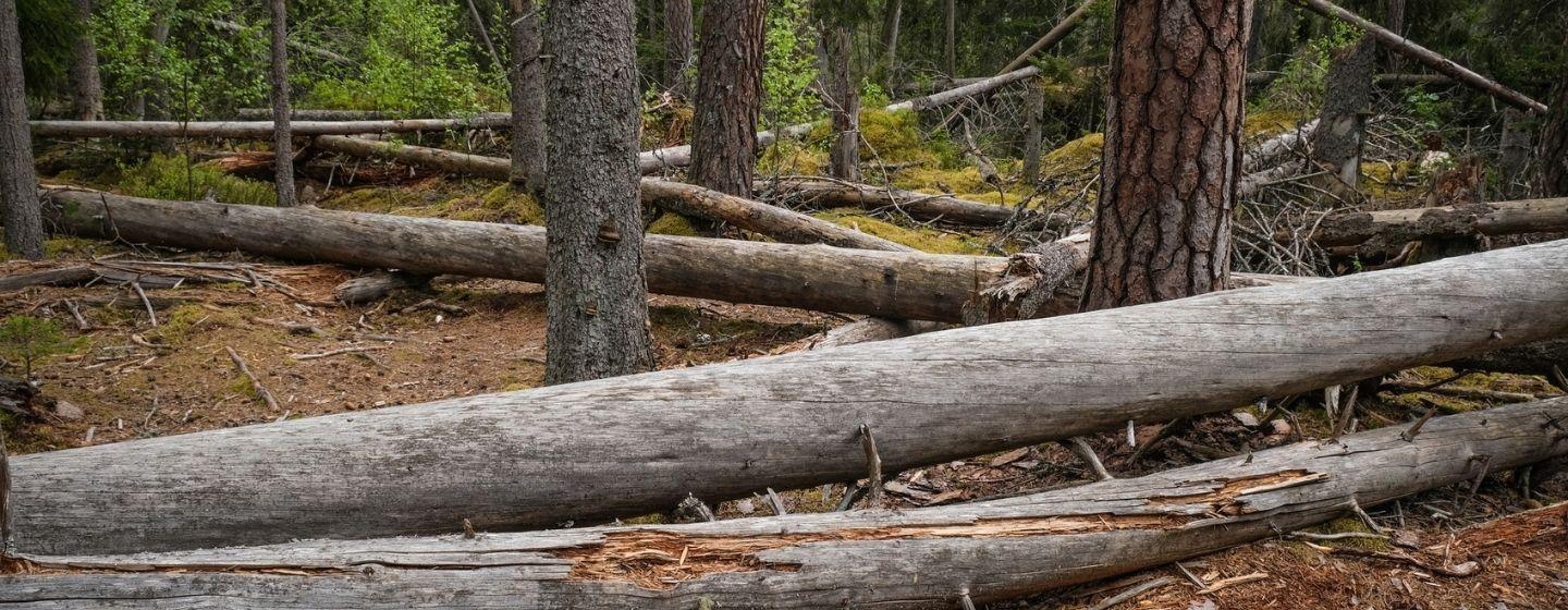
Both reports say winds, flooding and landslides caused by Helene damaged roughly 821,906 acres (about the area of Rhode Island) of forestlands in western North Carolina. Forestlands were toppled in 17 counties, but six counties experienced the most serious forest damage: Avery, Buncombe, McDowell, Mitchell, Henderson and Yancey.
That adds up to about $213 million in damage.
The reports estimate 27% of forestland in the affected counties saw some damage. Private lands experienced the most damage, about 78%. That’s not surprising since most forestlands are privately held. The rest of the damage was on public lands owned by the US Forest Service or other public agencies.
“Immediately after the storm, we focused our efforts on helping first responders and emergency personnel gain access to isolated communities and critical infrastructure,” said James Melonas, forest supervisor for the National Forests in North Carolina, in a news release. “But now that we’ve had an opportunity to evaluate the best data available, we can begin to piece together a clearer picture of the sheer scale of the damage to our National Forest land. This is a recovery that will be measured in years.”
The reports were compiled using information from satellite data, aerial surveying and on-the-ground assessments. And the findings highlight the unusual and random ways Helene struck.
In some areas, sections of forest were completely flattened next to sections that appear unaffected. In addition, hardwood trees like oaks, maples, birches and poplars suffered more damage than conifers like firs, pines and spruces.
It’s not surprising to find that winds caused the most forest damage, breaking trees in half. After days of intense rain, winds also easily uprooted trees out of the saturated ground.
The reports also found that mountain slopes facing south experienced the brunt of the winds and heavier damage. That makes sense because the strongest winds in a hurricane are in the right-front quadrant (essentially 1 to 3 o’clock on a clockface), where winds blow in the direction the storm is moving. Winds moving that direction would strike a southern-facing mountain slope the hardest.
And the winds from Helene were strong and steady.
In a Facebook post, the National Weather Service’s Greenville-Spartanburg office said that while Helene lacked some of the usual structure of a hurricane when it reached the state, the storm still hurled 40–90-mph winds at North Carolina.
There were two areas of extremely intense winds, one in the Blue Ridge Parkway and Black Mountain area and the other around Roan Mountain, near the North Carolina–Tennessee line. Gusts in those areas averaged 80–90 mph.
The strongest winds recorded were on Mount Mitchell, the highest peak east of the Mississippi River. Those gusts reached 106 mph.
Despite the damage, the forests will recover, but it will take time.
“Everyone in western North Carolina is passionate about our public lands, and by working with our community of partners, from local and state agencies to nonprofits, we will soon begin mapping our path toward long-term recovery,” added Melonas.
To find more stories about Hurricane Helene as well as state and federal resources, visit pbsnc.org/hurricane-helene.