Once Rare Nuisance Flooding Will Be More Common
A solid understanding of flood dynamics is important for protecting people and property along the North Carolina coast. Now two reports provide new, soggy insights into how sea level rise, fueled by climate change, is affecting so-called nuisance or sunny day flooding (flooding when there are no storms) in addition to a phenomenon called compound flooding.
The National Oceanic and Atmospheric Administration (NOAA) says in its State of High Tide Flooding that coastal communities will see between three and seven days of flooding in the next few years.
However, by 2050, sunny day flooding is likely to occur between 45–70 days per year.
Long-term projections are based on the range of expected relative sea level rise, which is projected to rise about one foot by 2050.
Nowhere for Water to Go
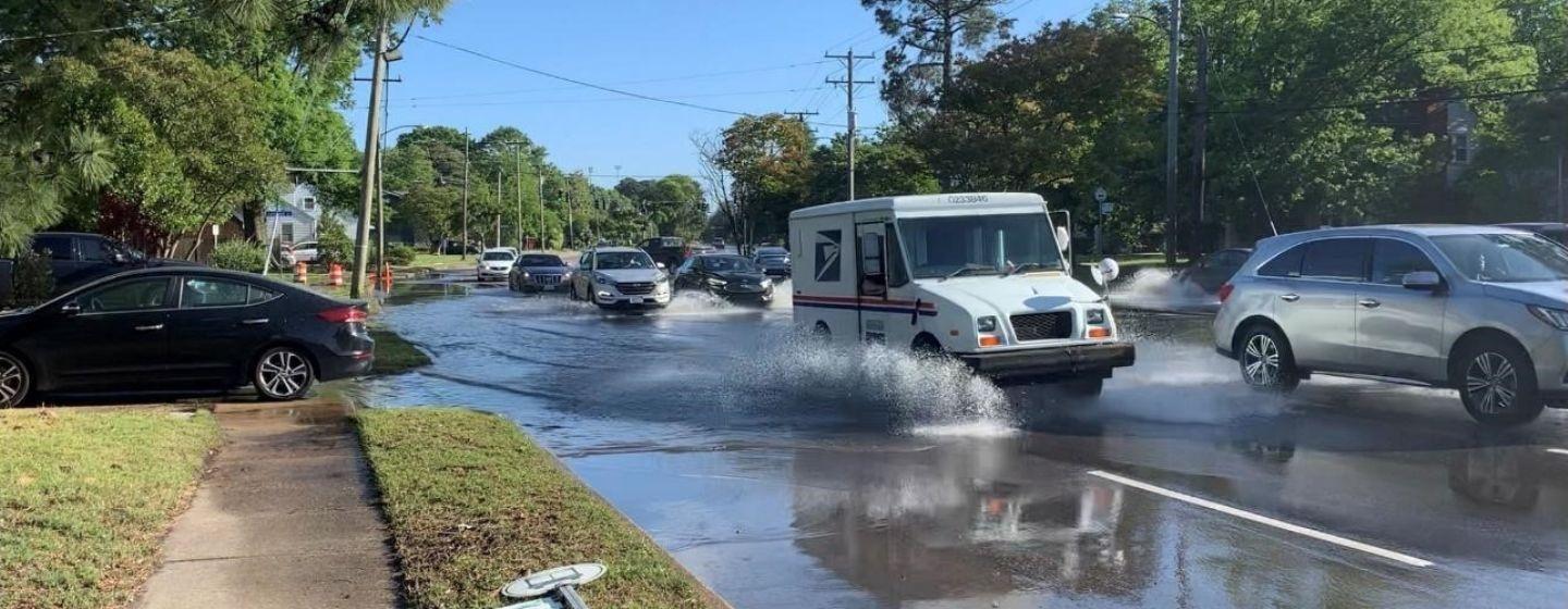
Nuisance flooding happens when tides reach anywhere from 1 3/4 to two feet above the daily average high tide, causing water to spill into the streets or bubble up from storm drains that aren’t designed to handle that much water.
NOAA has released an annual outlook on coastal high tide flooding since 2014. NOAA researchers use data gathered by tide gauges on U.S. coastlines to make their predictions.
“The gauges are recording the steady creep of sea level rise and a rapid increase in high tide flooding,” said William Sweet, an oceanographer with NOAA, during a conference call when the report was released. “As sea levels rise, damaging flooding that happened only during a storm will happen more regularly, even without severe weather.”
Sweet acknowledged that some communities are experiencing more flooding than others and the threshold is an average and doesn’t fit all coastal areas.
“Our goal is to provide guidance and get communities thinking and planning, because we know every inch matters at this point,” added Sweet. “The increase in sea level rise impact is happening now and the impact is growing, which is complicating preparedness planning.”
UNC-NC State Report Adds Another Watery Dimension
While NOAA’s flood observations are based on data from tide gauges, which measure changes in water levels due to tides, storm surge and river flow, researchers from UNC and NC State found the agency’s report doesn’t record flooding caused by rainfall.
Flooding due to rainfall accounted for almost one quarter of the 24 flood events they observed when studying historic Front Street in Beaufort June and November 2021. That five-month period is traditionally known as hurricane season, although meteorologists believe climate change is causing storms to form earlier in May.
UNC and NC State’s findings are contained in a report testing a new, real-time sensor framework for detecting and measuring coastal flooding.
The new findings about rainfall-induced flooding fill in a gap in flood observations. The problem is that downtown Beaufort is so developed, rain can’t soak into the ground so it instead flows into the underground drainage system.
“Ideally that would flow out to the sound or to Taylor’s Creek,” Adam Gold explained to Coastal Review. Gold led the study and is a former researcher with the UNC Institute for the Environment. He is now with the Environmental Defense Fund.“But what we’re seeing is with these higher water levels in the tidal creek, that water is creeping up into the stormwater network.”
The drainage system eventually fills, and water spills out onto streets and sidewalks.
“That’s the exact kind of flooding that future projections of coastal flooding don’t take into account,” Gold said.
What Is Compound Flooding?
Flooding that combines the effects of sea level rise and rainfall is called compound or rainy day flooding. While it accounted for 25% of flooding during the study period, sunny day flooding accounted for the rest.
Compound flooding is important to measure because flooding is becoming more frequent due to the combination of sea level rise and heavy precipitation events.
Gold believes quantifying the frequency and severity of compound flooding will help communities prepare to adapt to sea level rise. Community preparation is key because flooding can be hyperlocal as it’s dependent on an area’s vegetation covering, proximity to bodies of water, topography and even winds.
Want to learn more about sunny day flooding on the North Carolina coast? Watch this video.