Well Known Stretch of Outer Banks Highway Removed
by
Published on
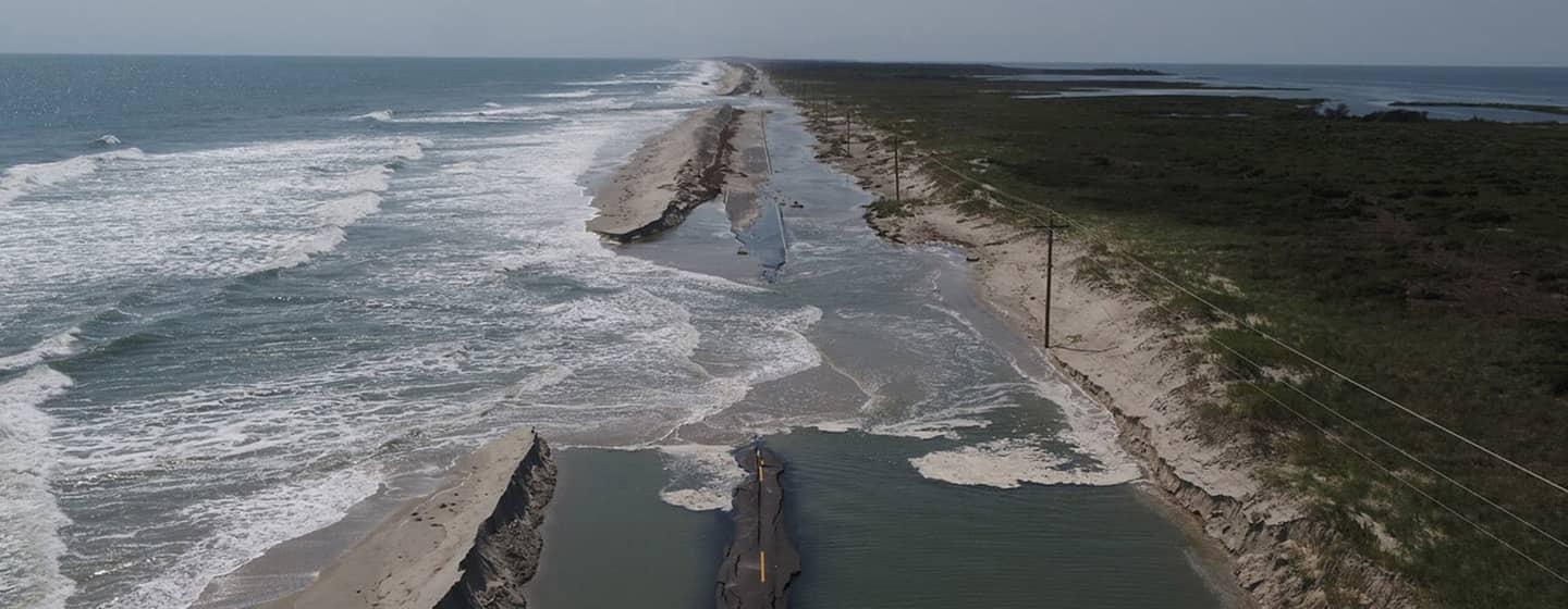
The stretch of Highway 12 known as the ‘S-Curve’ was a lifeline for southern Outer Banks Residents.
More recently it became a way to judge a storm’s strength, based on how fast it flooded and how much sand was left behind covering the road.
But by the end of the year, the ‘S-Curve’ near Rodanthe will be removed forever.
What some called an “iconic” stretch of road is doomed by rising sea levels, and North Carolina Department of Transportation crews are ripping up the pavement. The two-mile stretch will be returned to the Pea Island National Wildlife Refuge, according to NCDOT’s agreement with the U.S. Fish and Wildlife Service.
The highway section was no longer needed after the state opened the Rodanthe “jug handle” bridge in July. The two-point-four-mile bridge rises 24.5 feet over Pamlico Sound, protecting it from floods and over wash.
Contrast that to the ‘S-Curve’ section of Highway 12, which put drivers almost at eye level with crashing ocean waves and swirling sand. NCDOT kept heavy equipment nearby because of the continual need to clear sand from the roadway.
"The ‘S-Curve’ area had become one of the most vulnerable sections of N.C. 12, periodically facing ocean over wash that forced closures of the highway during nor’easters and tropical weather events,” said NCDOT in a statement. In fact, the stretch of highway was closed three times during the late summer because of tidal surges from Hurricanes Earl, Fiona and Ian.