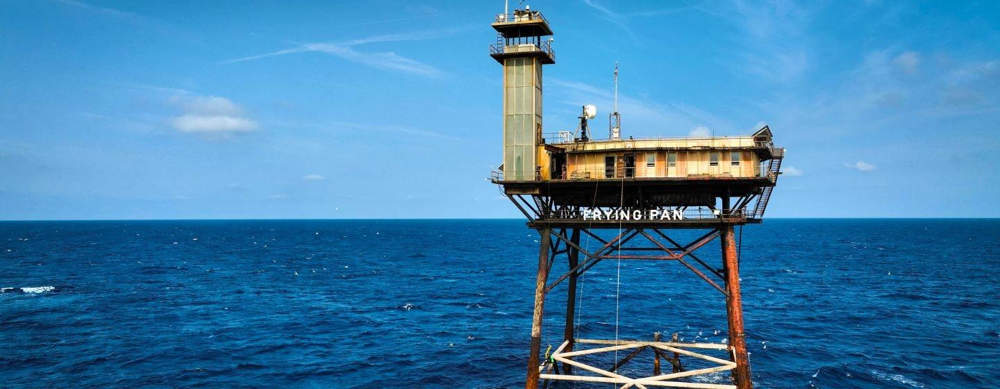
Searching for Sand at Frying Pan Shoals


When you think about North Carolina’s coast, the first image that likely comes to mind is the beach.
Yet, beaches make up just 300 miles of North Carolina’s 3,375 miles of coastline (about the width of the United States). You’d think there would be plenty of sand to cover them all, but you’d be wrong.
The North Carolina Department of Environmental Quality reports that our state’s coastal lands, including beaches, erode between three and six feet every year, depending on the location. Since sandy beaches are more susceptible to erosion than firmer terrain, beach communities and related industries like tourism are more vulnerable.
Because of that, local, state and the federal government have beach nourishment plans. The problem is, not much sand is available.
“Our region is at a deficit for sand,” said Joe Long, Ph.D., director of UNC Wilmington’s coastal engineering program. “For years, the region’s beaches have been eroding at alarming rates, and sand to build up the beaches has been increasingly harder to come by.”
It turns out there’s a lot of sand about 30 miles off the coast of eastern North Carolina. All that sand sits in shoals, or shallow waters, roughly the shape of a frying pan. That’s why it’s called, no surprise here, the Frying Pan Shoals. You’ve probably heard of it because of Frying Pan Tower, a former U.S. Coast Guard light tower that’s currently being restored.
The shoals are a unique ocean environment. Because of its location and shallow waters, there are strong currents throughout the area. That means it’s dangerous for boaters and is littered with shipwrecks. But the area is also filled with marine life, from shrimp to sharks. Unfortunately, little is known about it.
But it’s the sand that has drawn the attention of the Bureau of Ocean Energy Management (BOEM), the federal agency responsible for managing the nation’s offshore resources. Officials see the shoals as a possible place for dredging sand for beach nourishment projects in the Cape Fear region. The risks, however, are unknown.
So UNCW’s coastal engineering program has launched a $2 million, multidisciplinary research project with BOEM to study the shoals by collecting oceanographic measurements, biological samples and geological surveys to better understand its ecology.
“We have everything in-house to tackle this important project and understand this complicated environment from sea floor to the surface,” said Long. “We have experts in physical oceanography, biology, fishery science and geology—all of these people and disciplines are connecting to better understand the complex interactions at Frying Pan Shoals. In addition, we have the important infrastructure of the UNCW Center for Marine Science (CMS), which provides the research vessels, the technical support and the expertise to make it all possible.”
“The team is establishing a baseline understanding of Frying Pan Shoals’ ecosystem, which is essential for making scientifically sound policy decisions and ensuring safe and healthy coasts,” said Ken Halanych, Ph.D., director of CMS.
Researchers hope to finish the project in 2025.
To learn more about beach nourishment, watch this Sci NC story.