How Were 31 Pyramids Built with Giant Blocks?
The next time you pass by a building construction site, take a minute to watch what’s happening. You’ll be amazed by the ballet of machinery, steel and concrete and, of course, the skill of the workers who put it all together.
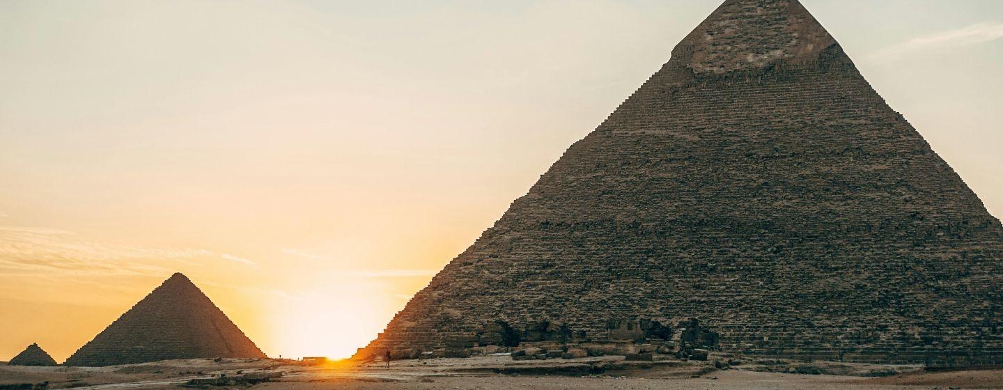
Now think about what it took to build the Great Pyramid of Giza in Egypt and the other 30 pyramids that are nearby.
The Great Pyramid is thought to have been built over two decades. It’s composed of 2.3 million blocks of limestone and granite, with each block weighing about 2.5 tons.
For years, scientists have studied how those giant blocks were moved to the construction site. It was originally thought that ancient Egyptians used a nearby waterway to transport materials, but nobody was certain of its location or size. So, the primary theory then became that a giant sled was used to pull blocks from a quarry to the building site over wet sand.
Now, researchers at UNC Wilmington (UNCW) have proposed a new idea in a research paper: The pyramids were built along a now abandoned branch of the Nile River.
“Many of us who are interested in ancient Egypt are aware that the Egyptians must have used a waterway to build their enormous monuments, like the pyramids and valley temples, but nobody was certain of the location, the shape, the size or proximity of this mega waterway to the actual pyramids site,” said Eman Ghoneim, Ph.D., professor of earth and ocean sciences at UNCW in a release. “Our research offers the first map of one of the main ancient branches of the Nile at such a large scale and links it with the largest pyramid fields of Egypt.”
How the river was found
Researchers used radar satellite imagery, historical maps, geophysical surveys and sediment samples to confirm the location of the now extinct river branch. The team estimates the branch of the Nile at that time was roughly 39 miles long and between 656 to 2,296 feet wide.
Researchers also gave the river branch a name, Ahramat, which means pyramids in Arabic.
The team also found the river branch bordered 31 pyramids, which were built between 4,700 and 3,700 years ago. The river’s location helps explain the high density of pyramids in a strip of desert near the ancient Egyptian capital of Memphis. The construction projects would have been accessible to the river.
The pyramids now sit in a desolate, inhospitable area of the Saharan desert.
Researchers also found evidence of causeways from the pyramids to the river, which suggests the river was used for moving construction materials and was “active and operational during the construction phase of these pyramids.”
So what happened to the river?
Evidence suggests a growing build-up of windblown sand, linked to a historic drought that happened almost 4,200 years ago, could be why the branch silted up and was eventually closed off.
The Nile River has always been the lifeblood of Egypt and remains so to this day. The UNCW researchers suggest additional study to find more extinct Nile branches could help prioritize archaeological excavations along the banks to protect Egyptian cultural heritage.