UNCW’s Seahawk-1 Opens a New Eye on the Ocean


You’ve got to admit—5,000 is an impressive milestone.
Think about it. 5,000 yards for a quarterback. $5,000 saved in a bank account. 5,000 words written in a novel.
Reaching that number is confirmation that whatever the activity is, it’s working and there’s a commitment to see it through.
It’s only appropriate then to offer congratulations to Seahawk-1, the University of North Carolina at Wilmington’s first nanosatellite.
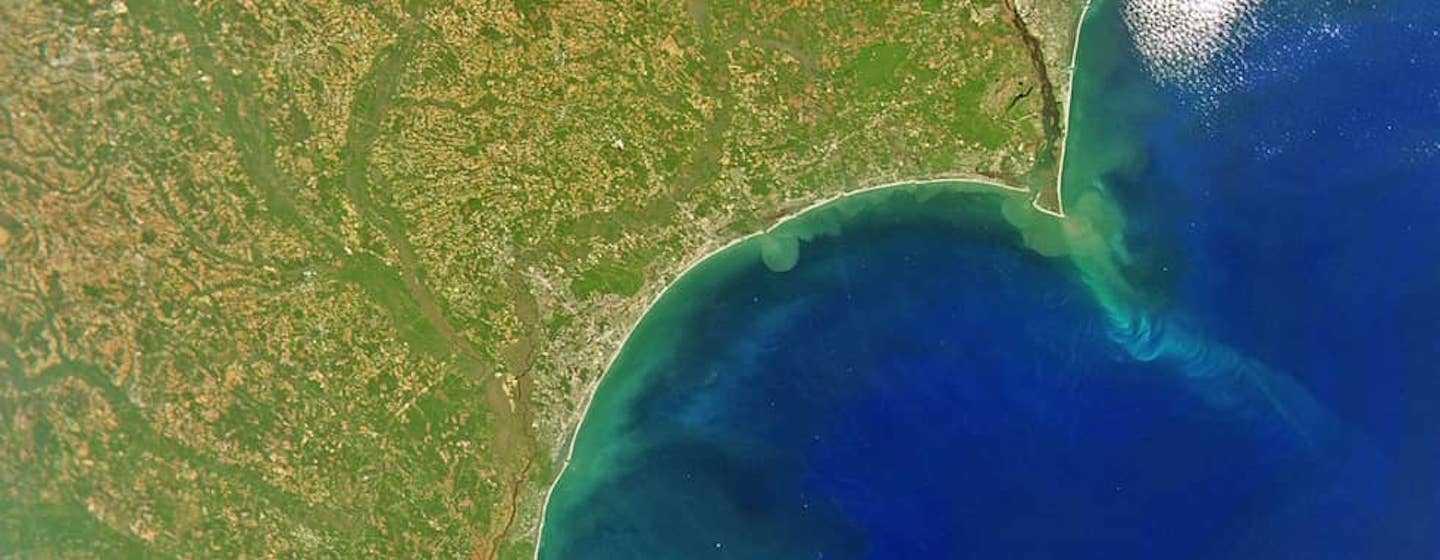
Seahawk-1 recently transmitted its 5,000th high-resolution color image to NASA.
That achievement proves Seahawk-1’s viability, but it also opens a new phase of ocean/coastal research that UNCW’s Center for Marine Science says will impact people around the world.
Launched in December 2018 and operational since June 2021, Seahawk-1 is a type of compact artificial satellite known as a CubeSat. It’s about the size of a loaf of bread and weighs around 11 pounds. It orbits Earth 15 times per day.
The spacecraft is equipped with the HawkEye ocean color imager, a tiny sensor with a 12-meter spatial resolution that collects 100 times more information per pixel than traditional satellites.
Yep, that means Seahawk-1 produces high-resolution photos almost 100 times clearer than other color ocean satellites in space.
“There are other ocean-focused satellites in space operated by NASA, the European Space Agency and others, but none offer the clarity of Seahawk-1,” said Philip Bresnahan, Ph.D., Assistant Professor of Oceanography at UNCW. “Because of the higher resolution images, we can see finer features on surface waters and land such as swirls, eddies and fine changes to water quality.”
“The data will enhance our understanding of ocean biology and complement the larger, polar orbiting satellites currently in space,” adds Bresnahan.
That fine resolution also allows scientists to monitor fjords, estuaries, coral reefs and other near-shore environments, where environmental stresses are often more serious and where there are security and commercial interests.
Another unique feature of Seahawk-1 is what it doesn’t do. The CubeSat doesn’t saturate the colors over land like other satellites do. That means scientists can see fine features on land masses like icebergs, beaches and riverbanks.
Seahawk-1 also monitors North Carolina’s intercoastal waterways and the Cape Fear River.
The photos are stored in a NASA database and are available to researchers worldwide to study a wide range of topics such as beach erosion, pollution, and the impact of climate change.
All HawkEye imagery is available free of charge via the NASA Ocean Biology Distributed Active Archive Center (OB.DAAC) on NASA’s Ocean Color Web.
In addition, NASA’s free comprehensive software package for the processing, display and analysis of ocean color data, known as SeaDAS, has also been updated to include the support of HawkEye.