Using Hikers’ Cell Phones for Science


Cape Lookout National Seashore preserves a 56-mile-long stretch of North Carolina’s southern Outer Banks, from Ocracoke Inlet on the northeast to Beaufort Inlet on the southwest. The wild horses on Shackleford Banks and the black-and-white diamond-marked Cape Lookout Lighthouse are all part of the seashore.
As is the Southside Loop Trail, a short trail through the maritime forest behind the visitor center on Harkers Island. Along the trail, hikers will spot a clearing in the trees, a wooden fence and a sign asking them to snap a picture.
The sign asks hikers to place their smartphone in the bracket at the top of the fence post, snap a photo and then email it to Chronolog, a citizen science initiative that keeps time-lapse records of parks, beaches and a host of other places.
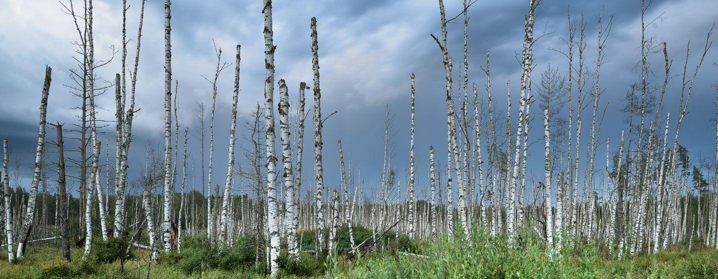
This chronolog location is part of a bigger project between the National Park Service, NC State and the Core Sound Waterfowl Museum and Heritage Center to track “ghost forests.” Ghost forests are regions where previously healthy coastal forests are being lost and converted to salt marsh habitat due to repeated exposure to saltwater. Dead tree trunks and stumps are common signs of a once healthy forest that is now declining and retreating further inland. The chronolog station on Harkers Island is one of almost two dozen NC State has helped coordinate along the coast.
“As the images track the ghost forest over time, we’ll have a better understanding of what’s going on in the environment around us,” said Nate Toering, Cape Lookout National Seashore chief of interpretation and education, in an email to Sci NC.
Ghost forests occur when healthy coastal forests are exposed to saltwater, either because of storms, tides, sea level rise or a combination of events. Plants and trees with low salt tolerance die off and are replaced with a salt marsh habitat.
Toering said National Seashore staff are finding more salt-tolerant species in areas that didn’t have those types of plants and trees before. They’re interested in watching and measuring how the Harkers Island ghost forest expands as well as erosion in the area, because it’s unclear how the newer salt marsh habitat will protect the area from storms and sea-level rise.
“Ghost forests are not only a sign of climate change, but they are also a good indicator of how vulnerable coastal communities are to a changing climate,” Erin Seekamp, Ph.D., told Sci NC. Seekamp is a distinguished professor of resilience and sustainability at NC State and coordinator of the project. “Projects like this help students to not only be more aware of the changing environment but also of the effects of those changes.”
“Forests and marshes normally transform over decades and even centuries, but climate change is speeding that up on the scale of years to decades,” said Marcelo Ardón, Ph.D., associate professor in the Department of Forestry and Environmental Resources at NC State, in an email to Sci NC. “But that’s still pretty slow for us to see over time. With the chronolog photos, it will be easier to see the changes in the ecosystems.”
There are more than 500 chronolog stations in 45 states. 65,000 images have been submitted so far. Here’s a look at the images visitors to Harkers Island have uploaded so far.
The National Park Service plans a second chronolog station on a rebuilt section of a trail and walkway through a nearby salt marsh. The walkway was destroyed by Hurricane Florence in 2018. The second site will capture images of the ghost forest from a different angle.
For more on ghost forests, check out this 2023 story from Sci NC.